
The Sentiero Attrezzato SOSAT is one of the great classics of the Brenta Dolomites: a ridge itinerary that runs along a long stretch of the Bocchette, with ladders, fixed ropes and passages exposed in a dolomitic environment of great impact. Technically demanding — one of the most challenging of the Bocchette — but exceptionally panoramic from the Rifugio Pedrotti to the Bocca di Tuckett.
Starting from the Rifugio Pedrotti (2491 m), reachable from the Val di Genova or from Molveno following the CAI signs. From the hut follow the path north to the ’ attack of the Central Bocchettes — time of approach from the refuge: about 20 minutes.
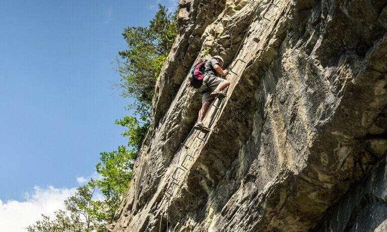
The SOSAT runs through the Bocchette Centrali of the Brenta Dolomites with a sequence of vertical ladders, exposed hinges, fixed ropes and aerial beams. The most challenging steps are in the central part of the route, where the walls rise and l’ exposure becomes significant. It climbs up to the Armi Mouth and then to the Bocca of Tuckett (2648 m), where the equipped section ends.
Difficulty Moderately Difficult. It is one of the most technical and challenging routes of the Bocchette di Brenta: it requires experience of ferrata, absence of dizziness and good physical form. It is not an itinerary for beginners.
From the mouth of Tuckett you descend to the Rifugio Tuckett and Sella (2272 m) following the CAI path. From here you can return to Madonna di Campiglio with the cable car or on foot. Total itinerary from ’ Tuckett Bocca attack: about 5 hours.
- DifficultyModerately Hard
- RegionTrentino-Alto Adige
- GroupDolomiti di Brenta
- Approach0:20 h
- Ferrata3:00 h
- Itinerary (a/r)5:00 h
- Hardware level difference200 m
- Route difference450 m
- Max2648 m
- Length7,5 Km